To Port Albert
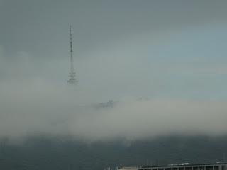
Today was expected to be a bland transfer day. But despite the weather it turned out rather well. The image shows the drab sky as we drive out on the M1.
The traffic coming towards us seemed rather light. That turned out to be because there had been a crash a few kilometres East and not much traffic was getting through. This explained why Google Maps had shown a route using the M3 at 7am: while the crash was on the other side of the road, the gawk effect on 'our' side would have been significant.Whatever: we proceeded along the road to about Pakenham and then wobbled around some minor roads before joining the South Gippsland Highway. This took us to the Strzelecki Ranges including the small, and attractive, town of Korumburra.
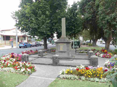
We passed through Leongatha, which despite being described in one website as the centre of South Gippsland, seemed to have very little attraction. In contrast Meeniyan was very nice and seemed to be a centre for coffee drinking. The very floral War memorial (with broken column) was obviously well cared for.
Our next stop, for pie and information, was Foster (not to be confused with Forster, NSW - also pronounced "Foster" but 1200 km away). The artwork was by apprentices at the TAFE and kids from the High School: I have been unable to work out the theme to which they were working, but it would be a nice place to get out of the sun - which had not yet made an appearance.
A nearby mural depicts the arrival of gold miners at Stockyard Creek in about 1871.
Art outside the Visitor's Centre. The lady staffing the centre was very enthusiastic and knowledgeable and gave us a stack of information.
RSL Memorial Hall.
We thought about going to Toora Bird Hide as this had featured in a twitch (I can't be sure but I think for a Hudsonian Whimbrel). However it appeared from the leaflet that the tide had to be 'right' which was unlikely on this day. So we passed going instead to the Agnes Falls. This took us up an escarpment, passing the wind farm.
The Falls were pretty good, as might be expected for what is claimed to be the highest single span falls in Victoria. Here is the geology.
Here are the Falls: I would love to see the definition of "single span" but they are OK.
The top of the falls is a concrete wall, providing a dam to keep an impoundment which provides water to a bunch of local towns, including Yarram.
The next two images show the power of trees. The first image shows a large eucalypt on the far side of the gorge. Presumably it was initially a seedling that lodged in a crack in the rocks.
As it has grown it has cracked and moved the rocks to get space.
The wind farm was just visible in the distance.
Going down the range into Welshpool we went out to check the Long Jetty. I couldn't get a good image so this snip from Google Earth shows the current jetty.
Walking out a lot of dots were visible on the mud.
These turned out to be Soldier Crabs (Mictyris platycheles).
This monster - at least 2m across the wings - stingray was cruising below the fish cleaning station, munching the material thrown in by the fisherpersons. Experts on iNaturalist have identified this as a Smooth Stingray (Bathytoshia brevicaudata)
A flock of Pacific Gulls were also tucking in the the scraps, This shows the massive bill and the red markings thereon.
The whole bird.
An immature of the same species.
Black-faced Cormorant.
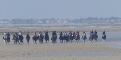
We saw some dark shapes in the distance: were they Cormorants? Bits of a wreck? To our surprise they were people on horseback riding along the sand.
A bloke told us they had been mustering cattle on an island. I got a little confused as to where they had been but suspect it was Sand Island. The red arrow marks where we saw them and the green looks to be where they crossed. There seems to be a marked track they follow and the riders only get wet to the knees (unless the horse goes into a hole in which case it has to swim and much more wetness happens).


Comments
Post a Comment